Thursday, March 31, 2011

The Walking Dunes, Hither Hills State Park, Montauk, LI, NY


Hello from Hither Hills State Park in Montauk on the south shore of Long Island.  I'm sitting on what's known as the "walking dunes".   These dunes will "walk" when strong winds cause them to move, but as they walk, they bury forests, trees and anything that stands in their way. These winds are so powerful because they are funneled from the west to the north.  They blow from the northwest and cause the dunes to move in a southwesterly direction.  
Top of a tree sticking out of a dune
The average dune "walks" about 3/12 feet per year.  Headlands are responsible for the accumulation of sand to the area.  These "headlands" are points of land that stick out into nearby Gardiner's Bay.  Ocean currents erode the sand from the beaches on the headlands, carry it into the area, then wash up on the beach where it is picked up by the wind.    

Some of the trees, like the one you see in the picture to the right are still alive.  That's because their roots have connected to groundwater below the sand.


You can follow, as we did, a 3/4 mile trail that travels through the dunes where you can glimpse these dunes, the wildlife and the phantom forests up close.  There are wetlands to explore as well as the "Cranberry Bog" where you can see cranberry plants, wild orchids and carnivorous plants.


Cranberry Bog area from atop one of the dunes

 While exploring, you are requested to stay on the trail and not climb the dunes thereby preventing erosion. 
These dunes are unique to the Montauk area and are worth a trip to see them. 


Unfortunately, there won't be a lot of links to the Walking Dunes.  Most of the information that I'm sharing with you has come from a pamphlet which you can grab at the start of the trail. 


Here are some of the links:
Short Escapes,  This link gives a rather interesting account of the area including the history


http://shortescapes.net/Cowboys---Tribes--Poachers---Spies.4039360.html


These are directions to the walking dunes and some history of the Montauk area
http://www.onmontauk.com/montauk-parks.shtml

Hiking with your dog.

Saturday, March 26, 2011

Whisper the Bull, Smithtown, LI, NY

This is the fourteen-foot, five-ton bronze statue of Whisper the legendary bull, a story of which I will impart later.  He stands at a well known intersection and is a familiar sight around the Smithtown area.  You can't miss him.

In 1903, Lawrence Smith Butler pitched the idea of the bull statue to Charles Cary Rumsey, his friend and sculptor known for his work with wildlife.  Butler was a descendant Richard Smith, the founder of the village of Smithtown.
   
In 1923, the casting for the statue was completed in Brooklyn,  but the bull never moved to Smithtown for lack of funds.  Eventually it became a part of an exhibit in the Brooklyn Museum and was later moved into storage,  In 1941, Mr. Butler was able to raise the funds required to bring the statue to the village and convinced the Town Board to build a pedestal for it.  He also convinced the sculptor's heirs to donate it to the town.

On May 10, 1941, Whisper was presented to Smithtown by Mary Rumsey, the daughter of sculptor, Charles Cary Rumsey.


By the way, Richard Smith's bull originally didn't have a name. Whisper was named by elementary school students when the local paper ran a contest.

I did promise you the legend of Whisper the bull and here it is straight from an article I found on the web:

"As the story goes, the Indians made a pact with Smith, an English settler who knew a good real-estate deal when he saw one: He could keep whatever land he circled in a day's time riding atop his trusty bull named ``Whisper.''

A clever man, Smith waited for the longest day of the year, circa 1665, to undertake the trek. He even trotted out one of Whisper's favorite cows the night before to trace the route. Her fetching scent would surely quicken Whisper's pace and get Smith to the end of the 55-mile border in time. He would start at the east end of what is now Smithtown, go south to Raconcamuck, now known as Ronkonkoma, then west to Hauppauge and north along what is today Veterans Highway and on to Town Line Road, which marks the town's western border, and finally north to the edge of Long Island Sound.

At noon, he -- and the bull -- rested. Smith munched on bread and cheese in a hollow, inspiring the name Bread and Cheese Hollow Road. Naturally, Smith got 'round, and Smithtown was his."


The article goes on to explain how Smith (spelled Smythe originally) really founded the town:

"That's the legend. Now here's what historians say really happened. Before Smith ever thought of founding a town in his name, he came to Southampton.

Actually, Smith first got off the boat, the John of London, from England at the Massachusetts Bay Colony in 1635. Because land there was already scarce and the Puritans extremely severe, he soon made his way to Long Island.

The first mention of Smith, then spelled Smythe, in the Southampton town records was in 1643. Soon after his arrival, Smith befriended Lion Gardiner, the first lord of the manor of Gardiners Island, and quickly rose into the fledgling settlement's highest social circles."
Smith riding his bull Whisper to set the borders for Smithtown.  From a 1939 mural.


Here's the rest of the story:

"Along the way, Smith must have tweaked a nose or two. In 1656, he was banished from Southampton for insulting the wrong people. The order is reprinted in Noel Gish's book, ``Smithtown, New York: 1660-1929.'' It reads:

It is ordered by the general court that Richard Smythe for his Irreverent carriage towards the magistrates contrary to the order was adjudged to be banished out of the towne and he is to have a weeks liberty to prepare himself to depart, and if at any time he be found after this limited week within the towne or the bounds thereof he shall forfeit twenty shillings.

Smithtown didn't come into play yet. Smith's next stop was Setauket, where in 1657 he set up house with his wife, Sarah, and their nine children.

Other forces were at work. The great Indian sachem Wyandanch gave Lion Gardiner a gift of land for rescuing his daughter, the Heather Flower, from a hostile tribe. Gardiner signed over the land that would become Smithtown to Smith in 1663. Smith either bought it or won it in a card game, depending on who's telling the story.

But the true tale doesn't end there. It took Smith a dozen more years of court battles to ensure that Smithtown was really his. When the English court didn't give him what he wanted, he tried the Dutch. And when the Dutch lost New York, he went back to the English. It went on and on. Finally, the last bits of Smithtown were declared his in the Andros Patent of 1677. Sounds like Smith was more of a bull than Whisper was.

``If you think about the fact that he got to two colonial governors with his boundary dispute, I think he was a very educated and determined man. He was absolutely determined to secure this land,'' said Hall. ``I wouldn't call him pushy, that's too modern a word.''

Though it's likely Smith's demeanor may have had something to do with inspiring the ``Bull'' myth, historians have come up with several theories. One is that Smith had a pet bull he liked to walk around town. Others point to Smith's coat of arms: A bull rising out of a shield decorated with six fleur-de-lis symbols.

Then there's Gish's theory, an interesting take on papal bulls. Apparently, papal bulls, decrees issued to settle matters of church and state, were very popular during the 17th Century. Papal bulls were sometimes used to resolve boundary disputes between dioceses or parishes. Gish argues that Smith could have issued his own ``Smith Bull'' to solve, once and for all, his boundary disputes with the Dutch, the English and the neighboring town of Huntington.

Of course, many people, especially Smithtown residents, dismiss these theories in favor of the fanciful fiction. It may be full of bull, but it's Smithtown's bull.

``When I first heard it, I thought it was somewhat farfetched, but it was a lovely story,'' said Smithtown Supervisor Pat Vecchio. ``As the years go by, it seems less far-fetched to me. You hear it so often, you begin to believe it.''

Asked almost weekly about the legend, Hall has developed her own strategy for handling the ultimate question of authenticity. ``I show them the map done for the town's bicentennial. We talk about whether there were Indian trails along the route and how the bull could have covered that much territory if it was covered in underbrush. Then I let them decide.''"

Courtesy http://newsday.com/community/guide/lihistory


 I hope you have enjoyed the legend of Whisper and found out some interesting things about it.  I know I did.  Here are the links:

 Here's the article that I borrowed the story from and the pic of the mural:


Smithtown's official website


Article in Smithtown Patch about the history of Whisper:


Wikipedia article:


old photos of Smithtown :


Sunday, March 20, 2011

Artist's Colony, Oakdale New York

Once a part of William K. Vanderbilt's estate, Idle Hour, this quaint little residential community was once a sixteen acre farm complex.

The building that I'm sitting in front of was the entrance and is called the Clock Tower, which was once the water tower for the estate. The tower's clock, while the Vanderbilt's owned it, was wound everyday by a jeweler who lived in a neighboring town. 
The outbuildings included a stock barn, which housed a herd of fifty Alderney cows and bulls.  There was a creamery, poultry barns, piggaries, a duckhouse, dog kennels, an eagle house, a forge and a house for the farm superintendent.  There was also a barn where the farm horses were kept.  A pig wallow, which are next to the piggeries, has been restored.   However, none of these looked anything like your typical farm.  Each of these outbuildings looked like residences and were set up as row houses, making them look like one long house. 

One of the homes inside the Artist's Colony. 
 The Vanderbilt's left the estate in 1926 and the farm area was bought up by artist  Lucy Sawyer Pritchard Thompson and her son, William the 3rd.

Mrs. Thompson turned the farm area into residences and invited several of her colleagues to live and work out in Oakdale.  And so the Artist's Colony was born.

 Exhibitions were popular as were theatre group presentations.  A restaurant called the Tally Ho Inn was a well known stopping off point for residents and the public alike.


Today these are private residences but you can still ride up and down the streets and marvel at the quaint houses and streets with names like Featherbed Lane, Princess Gate and Frog Lane. 

There are creeks and canals to pass as well as preserved wetlands that are filled with all kinds of wildlife.  Rob and Susan have come down here many a time in years past, no matter what the season is.  In the summer, you just might encounter couples on bikes taking in the quiet history of the colony or some neighborhood kids selling iced tea or lemonade and some homemade cookies or tempting baked brownies.

Here are some links:

This is a great site.  Idle Hour, the Vanderbilt's estate, is now Dowling College.  This is their official website and this link provides a virtual tour as well as the history of the place.

http://www.dowling.edu/about/idlehour/history1.shtm

An article from examiner.com long island.  I borrowed one of the pictures from this article.  
http://www.examiner.com/landmarks-historic-districts-in-long-island/oakdale-s-idle-hour-artists-colony

Here it is on wikimapia
http://www.wikimapia.org/13207224/Oakdale-Artist-Colony

Old Long Island has some interior shots of Idle Hour as well as other Vanderbilt homes around the Long Island area. 
http://www.oldlongisland.com/search/label/Vanderbilt

Sunday, March 13, 2011

Laurelton Hall, Louis Comfort Tiffany Estate, Laural Hollow, LI, NY

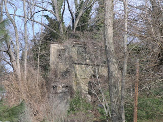
In back of me stands the minaret from Laurelton Hall, Louis Comfort Tiffany's estate in Laurel Hollow.  It's only a handful of ruins that's left of the original estate which burned to the ground in the late 50's.  It was originally used as a smokestack for the power house.

Ruins of the covered bridge
Laurelton Hall was built between 1902 to 1908 as Tiffany's country estate. Built on a hill overlooking the Long Island Sound, this estate had eight floors and was filled to the brim with his favorite art pieces from his own collection.  The number of rooms differ from each article and range from 65 to 84 rooms and also differs on the size of acreage which measures anywhere from 580 to 600.   On the grounds were conservatories, tennis courts, a private bathing beach and included 60 acres of formal gardens. 

It also contained the Tiffany Chapel which was housed in a separate building that was shown in the Columbian Exposition of 1893. 

In 1915, Tiffany opened a small school on the grounds of the estate,  In 1918 he began the Louis Comfort Tiffany Foundation as a summer retreat for artists and craftspeople.

Tiffany died in 1933, but the Foundation continued to function until 1946 when the estate was sold. It was abandoned soon after and fell into disrepair.  Laurelton Hall burned to the ground in 1957, but many of the original pieces were salvaged by owners of the Charles Hosmer Morse Museum of American Art in Winter Park, Florida.  In 2010, a new exhibit was built to display the remaining artifacts of the estate.  The loggia Laurelton Hall is still on exhibit at the Metropolitan Museum of Art in New York.

There are lots of links including black and white photos of Laurelton Hall in 1924.

Old Long Island with pictures of the Laurelton Hall estate
http://www.oldlongisland.com/2009/02/laurelton-hall.html

Article in the St. Petersburg Times
http://www.tampabay.com/features/visualarts/a-wing-devoted-to-tiffany-treasures-opens-at-the-morse-museum-in-winter/1156239

Wikipedia article
http://en.wikipedia.org/wiki/Laurelton_Hall

The Louis Comfort Tiffany Foundation
http://louiscomforttiffanyfoundation.org/

The Morse Museum Collection with more on Laurelton Hall and Tiffany.  Contains history and black and white photos.
http://www.morsemuseum.org/collection/laurelton_hall.html

Wikipedia article on Louis Comfort Tiffany

http://en.wikipedia.org/wiki/Louis_Comfort_Tiffany

Laurelton Hall Loggia a new site that is still under construction.  Gives a bit of the history and shows more black and white photos. 

http://www.laurelton-hall.com/loggia.html

Saturday, March 12, 2011

Caumsett, The Estate of Marshall Field III, Lloyd's Neck, Huntington, NY


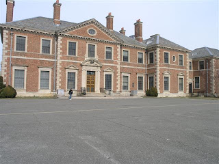
We spent the afternoon at Caumsett State Park in Lloyd's Neck on the north shore of Long Island.   The house is not open for tours, but you can hike its many trails, watch the horses run and play at the stables and just enjoy the surroundings at another Gold Coast estate.

Marshall Field III was the richest man in the world when he purchased a strip of land on Lloyd's Neck in 1921. It was a sizable fortune, inherited from his grandfather, Marshall Field I, who founded the now famous department store in Chicago. 

 Marshall Field III was famous for many things in his lifetime.  He was a publisher, philanthroper, merchant, banker, and farmer who owned several properties.   There was an estate in New York City, one in Chicago, another in Maine and a hunting plantation in South Carolina in which they all spent time.  But Mr. Field and his wife, Evelyn wanted to create a self sustaining country estate similar to one that the family enjoyed in England.  And so, in 1922, work began on one of the grandest of the Gold Coast estates, Caumsett, a Matinecock Indian word meaning "place by a sharp rock."

The Winter Cottage
After the lands were cleared, the Fields hired noted architect John Russell Pope to build everything that would require a self sustaining estate including Summer and Winter cottages and a stable for the polo grounds, not to mention the manor house and smaller homes for the caretakers and workers.  The famous Olmstead Brothers worked on the landscaping.  This estate was to be used for every outdoor activity; polo, hunting , riding, sailing, yachting , tennis and swimming plus a dairy and greenhouses.  The Field family and their guests could easily access the estate from New York City by airplane, yacht or car. 

Horses feeding at the stables
In 1961, Mrs. Ruth Field, Marshall Field's widow and third wife, sold the estate to State of New York with the promise that Caumsett would be "used forever for park purposes." and to this day remains a beautiful park with many things to see and do.  In 1996, the Caumsett Foundation was formed and in 2010 Caumsett State Park was designated as an historic park preserve for everyone to enjoy. 


New Stables
Here are some of the links that you will enjoy:


Official site of the Incorporated Village of Lloyd Harbor.
http://www.lloydharbor.org/village/brief_history.htm

Official site of the Caumsett Foundation which will explain in more detail about the history of Caumsett and for its future plans for the preserve.
.
http://www.caumsettfoundation.org/Caumsett_Site/History.html

More of the history of the estate plus an article from 1921 regarding the sale of the land to the Field family. 

http://www.caumsettfoundation.org/index_files/Page665.htm

Here are photos of what's left of the dock area including the sharp rock that Caumsett is named for.

 http://www.caumsettfoundation.org/index_files/Page798.htm

Wikipedia article.  Check out the external links, especially the second one which has black and white photos of some of the estate buildings that were torn down in 1970 and the inside of the manor house.  To see the pictures, click on the link provided then click on the camera icon to the left of the screen. 


http://en.wikipedia.org/wiki/Caumsett_State_Historic_Park

Official site of Caumsett State Park. The picture above is that of the old stables.

http://www.nysparks.com/parks/23/details.aspx

View from the rear porch overlooking  Long Island Sound

Sunday, March 6, 2011

Methodist Campground, Merrick, LI, NY


The area north of where I'm sitting was used as a Methodist campground from 1869 into the 1920's. It's also locally known as Tiny Town because of the small size of the cottages and small streets that encircle the camp, one inside of each other.
Religious activity was at its peak in the 1860's and Methodists from all over New York State met here every year for ten days. The campgrounds attracted anywhere from 300 to 10,000 people.   They would park their wagons inside the circles and live out of them.  Eventually, some of the parishioners built small cottages instead of living out of the wagons.  There was also a chapel and a minister's house built, which are local residences today.
These "camp meetings" were held all over the United States. With no permanent villages to contain the influx of new settlers and the lack of parishes, there arose a need for a place where Christians could worship thus the Campgrounds were born.  Similar to the revival meetings, these camp meetings were often led by traveling ministers who solved the problem.  The crowd literally "camped out" especially if it was a few miles away from their homes.  They could either stay for the entire meeting or leave after a few days.  Continuous services were held in which parishioners would take part. Hymns and religious song filled the air.

The chapel
There are camp meetings still held today in the United States mostly held by the Pentecostal and Wesleyan religious groups.
There are some links that I will include here.  
This Wikipedia article will explain more on  the camp meetings:

 Merrick Methodist Church site includes history of Merrick and the campgrounds. 
History of Merrick page.
New York Times article on Tiny Town
Here is the Wikimapia site showing the circular streets
Minister's House