Sunday, April 24, 2011

Maude Adams House located in The Convent of Our Lady of the Cenacle, Ronkonkoma, LI, NY


Happy Easter everyone.  It was so lovely today that we took a ride around the Island.  Rob had always wanted to find this house and, after gearing up our GPS stumbled upon the Maude Adams house. Located inside the Convent of Our Lady of the Cenacle, it is a retreat which is open to anyone who needs some space and quiet time away from our busy world.  
Maude Adams was a famous and very popular  actress in her day, simply known as "Maudie" to her fans. Ms. Adams was the highest paid performer earning one million dollars a year in her prime. She was the first woman in America to play Peter Pan at four different times, 1905, 1906, 1912 and 1915.  She also starred in another of Barrie's plays called The Little Minister in 1897, 1904 and 1916 in a role written especially for her.  For all you Somewhere in Time fans (along with the book Bid Time Return by Richard Matheson on which the film is based) the character of Elise McKenna, portrayed by  Jane Seymour, is based on Ms. Adams. Susan and Rob are big fans of both the film and sci fi novel.
Born in Salt Lake City, Utah as Maude Ewing Adams Kiskadden on November 11, 1872, to a Mormon family, although Maude herself did not practice the faith. 
The house
Her father died when she was six, leaving Maude with her mother, an actress, who frequently carried her on stage in her arms.  Maude began her acting career at age five. Although described as shy,  she could appear dignified and refined at times.  She was known to help out young actresses and actors of her day with money from her own pocket. 
Ms. Adams made her New York City debut at 16 in The Paymaster after touring in California and Boston.
All told, she did twenty six plays before retiring in 1918 to a home in Ronkonkoma called Sandy Garth, which was originally built by the Smith's of Smithtown a decade earlier. 
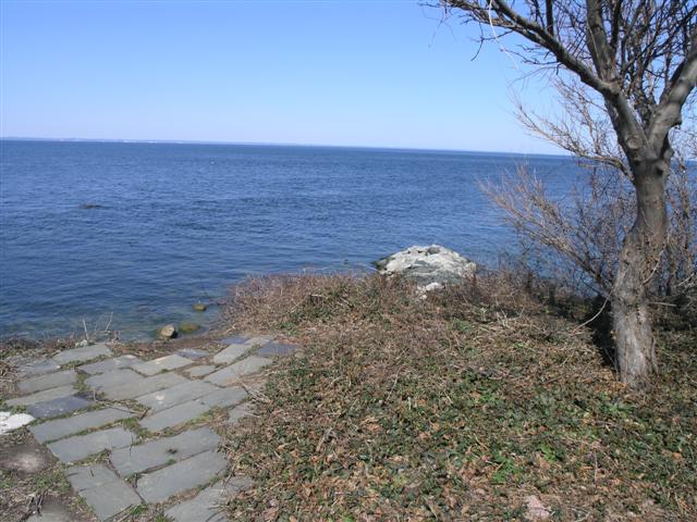
Lake at the side of the house
In 1927, Maude Adams donated her 400 acre farm and estate to the Cenacle Sisters as a gift for the help she received from overcrowded St. Regis Cenacle in New York City after a breakdown in 1919. Maude Adams died in 1953 at her home in Tannersville, New York, but is buried at the Convent along with her friend and personal secretary, Ms. Louise Boynton.  Due to construction of a new retreat building, we did not go searching for the gravestone, however, I did borrow a picture which is below.   
 
 Here are some of the links that I found:


Wikipedia article
http://en.wikipedia.org/wiki/Maude_Adams

Image gallery of Maude Adams
http://digitalgallery.nypl.org/nypldigital/dgkeysearchresult.cfm?keyword=maude+adams

Find a Grave where I borrowed the picture from.
http://www.findagrave.com/cgi-bin/fg.cgi?page=gr&GRid=8

Cenacle Sisters website:
http://www.cenaclesisters.org/provincial/news-and-events/show-detail.aspx?id=156

Long Island Oddities website:
http://lioddities.com/Bygone/maud-adams.html

Article from the Lake Ronkonkoma Civic Association, 2008, regarding the Cenacle Sisters construction of new retreat house
http://www.lakeronkonkomacivic.org/announcements/files/426bb0109dc7f42c0e243aeec8babb03-69.php

 Here is an extended article about the film Somewhere in Time and how it relates to Maude Adams and Richard Matheson.  It's a very informative article with lots of quotes from the film and book.  Enjoy.

http://www.ldsfilm.com/movies/SomewhereInTime.html

Sunday, April 17, 2011

Old Field Point Lighthouse, Old Field, LI, NY

This is the Old Field Point Lighthouse located in the village of Old Field, LI, NY.  The need for a lighthouse in the area increased as maritime traffic steadily grew and warnings regarding the rocky shoals and sand reefs went unheeded.


The first lighthouse on this site was built between 1822 and 1823.  It was a plastered octagonal stone tower that stood 30 ft. tall.  Its light was visible for 13 nautical miles.  In 1868, it was replaced with the current lighthouse  which is now a two story granite structure, it stands 74 ft. tall.

This lighthouse has a colorful history.  The first female keeper took over from her husband after his death in 1826.  She held the post for six months until the next keeper, Walter Smith, who took over in June 1827.  In 1830, when Mr. Smith passed, his wife Elizabeth took over and she held the post for twenty six years after which she was succeeded by another woman by the name of Mary Foster.

Keepers of the lighthouse also assisted with stranded vessels as in 1923 when Keeper Richard Ray rescued two men and brought them into the lighthouse where he gave them clothing, food and shelter for two days.

The lighthouse was deactivated in 1933 and was replaced by a steel tower built next to the lighthouse. In 1935, the Village of Old Field took over the property which was now to be used "for public park purposes."  That purpose changed in 1941 when the government took over the station as well as nearby Horton Point Lighthouse after the bombing of Pearl Harbor.  After the war
both were returned to their original status. 

Old Field Point Lighthouse continues today as a home for the Village's Chief Constable.  The Coast Guard now maintains the lighthouse which was replaced with a modern beacon in 1991. Since 1963, the Village Hall is now housed in the 1824 keeper's house.   


 Here are the links:


There is more information and pictures on this site for you to enjoy.

Lighthouses of Long Island New York


The official site of the Incorporated Village of Old Field Island

Wikipedia article

Sunday, April 10, 2011

High Hill Beach, LI, NY

The road I'm sitting on  is a hiking trail which now leads to what was once a summer colony named High Hill Beach. It was in existence from 1900 to 1939 when it was destroyed by Robert Moses to make way for Jones Beach State Park.  When it first began, High Hill Beach consisted of 20 to 30 cottages that were built on leased land just before the turn of the 20th century.  As the summer community grew and became more active, so did the number of cottages and vacationers.  At it's peak, High Hill Beach contained a total of 98 cottages, a boarding house, a hotel-casino, a life saving station and a post office. 

At least 20 or 30 houses were moved to the gated hamlet of nearby West Gilgo Beach, where they can still be seen from Ocean Parkway today if you know where to look.

The community was located on a crescent shaped eastern rim of Zach's Bay nestled among the dunes toward the surf.  Apparently, it was a quiet community uninterrupted by any sound at all. There was a long narrow boardwalk linking the bay to the  cottages on the ocean side.  

Before construction of the Wantagh Causeway leading down to Jones Beach, vacationers arrived at High Hill Beach either by ferry or private boat.  The ferry would leave from Bellmore and would take 40 minutes to arrive at High Hill.  In 1928, a one way trip to the beach cost 40 cents and a round trip cost 70 cents. 

Area where High Hill Beach was located
  There were no telephones, no gas, little or no electricity.  There were a few radios.  There was no plumbing or toilets.  Each cottage had its own outhouse or privy and visitors obtained their water from wells and cooking was done on a kerosene stove.  There was a large pavilion which was considered the center of the community where people could buy a variety of refreshments anywhere from ice cream to sandwiches to some great clam chowder. High Hill Beach also had a lamplighter. Its kerosene lamps were placed as needed by the boardwalk and were cleaned and refilled once a week. 
A picture of Savage's Hotel and Casino at High Hill Beach

The picture above shows Savage's Hotel and Casino, which was originally the Sportsmens Hotel built by R.T  Wilmarth in 1900. He sold the hotel in 1917 to M.F. Savage.

High Hill Beach community taken from Savage's Hotel.  Notice the boardwalk.


Jones Beach State Park was opened in 1929 and the community of High Hill Beach was given 11 years to relocate.  By 1940, 38 of the cottages were moved to West Gilgo Beach and the rest destroyed along with Savage's Hotel.  The area is now used to service Jones Beach as a maintenance station.
Gated hamlet of West Gilgo Beach
Here are some links that I am including:

 A small piece of history about High Hill Beach
http://seafordny.blogspot.com/2007/03/high-hill-beach.html

Article about the history of High Hill Beach where I took most of my information from. Very interesting article with pictures and remembrances of summer community residents. 
http://www.highhillstriperclub.com/history_name.htm

This is an interesting article and contains the image black and white image that I used with the boardwalk.  It explains some history of High Hill during the time of construction of Jones Beach State Park.
 http://www.longislandtraditions.org/southshore/communities/easternnassau/easternnassau.html

More pictures and postcards from High Hill Beach from the Levonius family. It shows the life saving station, the boardwalk and some of the cottages in the community.   
http://www.levonius.us/hhb.html

Wikipedia article on West Gilgo Beach.
http://en.wikipedia.org/wiki/West_Gilgo_Beach,_New_York

Wikimapia of approximate location of where the community of High Hill Beach once existed
http://wikimapia.org/4156215/Approximate-location-of-High-Hill-Beach

Wikipedia article on Jones Beach State Park

http://en.wikipedia.org/wiki/Jones_Beach,_New_York

Theatre at Jones Beach on Zach's Bay across from what was once High Hill Beach.

Sunday, April 3, 2011

The 1902 Marconi Building, Rocky Point, LI, NY

I'm sitting in front of one of  five radio shacks built in New York, this one being the fourth and is still being used today.

Originally located in Babylon, New York, this small Marconi Wireless Station was used to transmit with ships at sea.  The wireless station stood next to the Jacob's cottage which was on a five year lease to the Marconi Wireless Telegraph Company.  The cottage and the small station served as a station and a training school as well as an office and generating room on first floor of the house. The second floor was where  messages were sent and received. 
The Jacob's cottage in Babylon, NY with the radio shack next to it
The Marconi Wireless Telegraph Company operated for 10 years until the Marconi Method, which was the best way to send and receive messages,  became obsolete due to short wave technology.  For 20 years, the building was used for electrical experiments by local boys and as a paint storage shed by the farmer who owned the property.

The building was first brought to the attention of radio pioneer Edwin H. Armstrong by his friend, a former third assistant Technical Officer who used to work at the Babylon station.  In 1930, Armstrong bought the station and moved it out to its present location in Rocky Point at which time he gave the building to the RCA Transmitting Station in Rocky Point where it was stood in front of RCA's Building #1.  It was later stored inside a barn where it deteriorate so badly that it couldn't be moved to the 1939 World's Fair.  The little shack survived two fires while inside the barn.

The sign on the door reads:  "Gugliemo Marconi's 1902 ship to shore wireless station and training school operated in Babylon for five years. In 1930, radio pioneer, Edwin H. Armstrong purchased and gave the building to the RCA Radio Central Transmitting Station in Rocky Point.  Upon Closing of Radio Central, ownership was officially given to the Rocky Point School District #9 in May of 1969.  Rocky Point Historical Society, November 5, 2006."

In 1969, due to satellite communication, RCA was planning to close the transmitting station when it again changed owners. RCA Station Engineer, Robert Lundquist presented the Marconi Station to the Rocky Point Free School District #9 at the suggestion of Mr. Frank J. Carasiti  and was moved from the barn across the street to the Joseph A. Edgar School where, in 1972, the building was finally renovated. 


The little station would be moved again in 1989 before it was moved to its final home at the Frank J. Carasiti School in 1994 where it currently sits on the grounds today. It has been used by amateur radio groups since 1987.     

Here are links to several interesting articles with a more detailed history and some pics.

Article titled The 1902 Marconi Building where I borrowed some of my information and two pictures. 
http://www.rockypointhistoricalsociety.org/Marconi%20history.htm

Long Island Ruins and Remnants site which contains a lot of good information.

http://li-ruins.com/index.php?option=com_content&task=view&id=41

Wikipedia article on Guglielmo Marconi:
http://en.wikipedia.org/wiki/Guglielmo_Marconi

Arcticle on Marconi Wireless from the Titanic and Nautical Resource Center.
http://www.titanic-nautical.com/Marine-Wireless-G-Marconi.html

Radio Central Amateur Radio Club's official site
http://rcarc.org/imdhist.htm


Original site in Babylon NY where the wireless station once stood

Saturday, April 2, 2011

South Lake Worth Inlet, Boynton Beach, Florida

Back in sunny Florida again, at South Lake Worth Inlet or Boynton Inlet as Rob and Susan have been calling this great park.  This is Rob's favorite spot when they come to Florida.  Tons of pelicans used to hang around here, but for some reason, they stopped coming a few years ago.  Right now, as you can see, there is major construction to the buildings and the pier so there wasn't much for us to do when we took this photo last year.

Planning for the Boynton Inlet began in 1913 and the Florida Legislature approved its construction and set up a taxing district in 1915. The inlet was needed for two reasons: shipping and transportation and, more importantly, for health and sanitation issues since the water quality was declining in Lake Worth.   

In 1924, the Army Corp of Engineers issued a permit for the inlet to be built and in 1925 construction began. Boynton Inlet opened officially in March of 1927.
Waves crashing over the seawall

In 1932, an Ocean Beach resident built a 2000 foot seawall to protect his property from erosion and is known as the "McCormick Wall."  It has been upgraded several times.  A sand transfer plant, the first of its kind anywhere, was set up in 1937 to prevent erosion.  It was closed down in 1942 due to fuel shortages during World War II, but severe erosion to the inlet developed and in 1945, the plant resumed operation.

There were several more updates to the inlet, the most recent in 1974 when the bridge over the inlet was rebuilt.  Palm Beach County took over operations of the inlet when Governor Lawton Chiles abolished the taxing district in 1996. 


Fishing boat going through Boynton Inlet
Boynton Inlet is a great place to relax and enjoy.  You can sit and relax or take a walk on the pier and watch the fisherman there.  There are picnic tables set up where you can enjoy a lunch or just watch the boats go through.  You can also walk to the beach, collect shells or take a dip in the water.  See some of the local birds that land there and watch the sandpipers run up and down the shoreline.  The park does fill up on weekends and sometimes there is no place at all to park (although Susan and Rob have never lacked for a spot) but do get there early.


As usual, I have some links:

Trip Advisor.  There are reviews about the inlet and some great pics to check out. 

http://www.tripadvisor.com/Attraction_Review-g34094-d117432-Reviews-Boynton_Inlet-Boynton_Beach_Florida.html

A PDF link to the history of the Florida inlets. This is where I got most of my information. South Lake Worth Inlet (or Boynton Inlet) is on page 14.  I found this very interesting and informative. Pics and maps are included to let you see exactly where and when the construction was done. 
http://www.pbcgov.com/erm/coastal/shoreline/beach/pdf/history-inlets.pdf

A youtube video showing the beach at the inlet.  If you look to your right, there are several videos on Boynton Beach. Check them out as well if you've never been. 
http://www.youtube.com/watch?v=rvWGDjYtHrE


Town of Ocean Ridge website.  A paragraph on the South Lake Worth Inlet and some history of the town and its surroundings. 
http://www.oceanridgeflorida.com/TownHistory.htm

South Lake Worth Inlet webcam
http://www.co.palm-beach.fl.us/webcams/slwi/

A1A bridge crossing over inlet